Featured NewsTrending NewsNASA FireSense Project Upgrades Drones

post1

21 February 2025


Above photo courtesy of NASA.

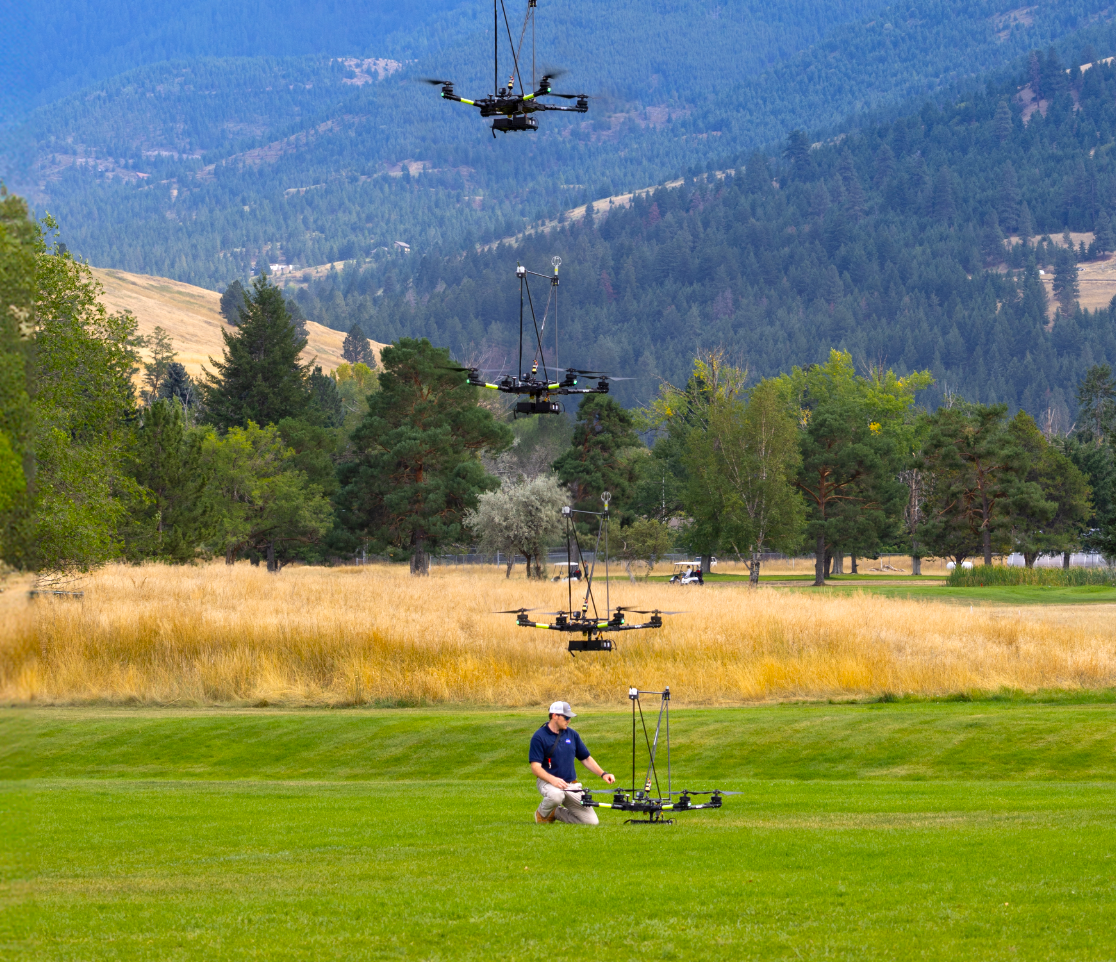
The NASA FireSense project has added two sensors to its Alta X quadcopter to help operational agencies with better wildland fire management. 

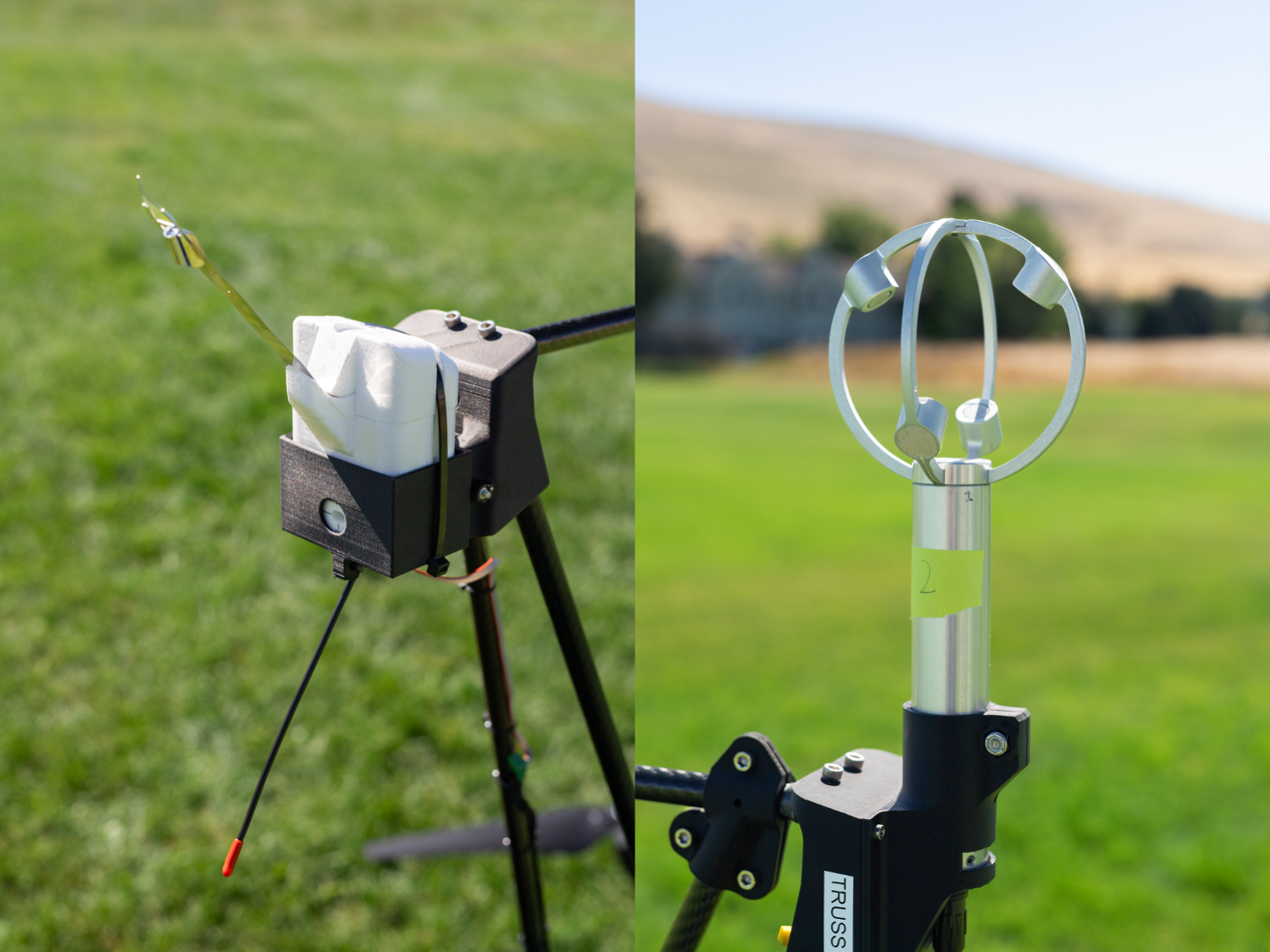
The enhancements are a radiosonde for measuring weather conditions—currently in use by the National Weather Service—and an anemometer that tracks wind speed and direction. Anemometers are usually deployed at weather stations and airports.

The localized, real-time data provided by drones are invaluable for helping fire crews forecast how to approach fire lines and community protection, while simultaneously reducing environmental and financial costs. 

NASA researchers had joined together in Missoula, Montana, during August 2024, to evaluate new technologies for micrometeorology, or localized weather forecasting. This gathering apparently helped devise the value of attaching wind sensors to the Alta X drone to help predict the behavior of a fire.

“Ensuring the new technology is easily adoptable by operational agencies such as the U.S. Forest Service and the National Weather Service was a primary goal of the Montana campaign,” said Jacquelyn Shuman, FireSense project scientist at NASA’s Ames Research Center in California’s Silicon Valley.

To that end, the Alta X drone was chosen for sensor integration by the team because the U.S. Forest Service currently has a fleet of the drones, as well as trained drone pilots.

“Anemometers are everywhere, but are usually stationary,” said Robert McSwain, FireSense UAS lead, based at NASA’s Langley Research Center in Hampton, Virginia. “We are taking a sensor type that is already used all over the world, and giving it wings.”

The two sensors mounted on the NASA Alta X to hopefully better predict fire and smoke behaviorsare a radiosonde (left) and an anemometer (right). Photo courtesy of NASA.

Drones offer valuable fire-control data, because they can be flown to continue updating measurements over a precise location as conditions change. Fire fighters on the ground can use this real-time information to make quick decisions about where to send resources.

“Drones are not meant to replace the weather balloons,” said Jennifer Fowler, FireSense’s project manager at Langley. “A weather balloon is going to be a one-off, and the attached sensor won’t be recovered. The instrumented drone, on the other hand, can be flown repeatedly. The goal is to create a drop-in solution to get more frequent, localized data for wildfires—not to replace all weather forecasting.”

Get Our Newsletter!

Don't miss out on essential news, industry updates, hot videos and photos, gear reviews, and more!