27 November 2024
A Ground Control Point (GCP) is a precisely measured location on the ground with known geographic coordinates. In aerial mapping, GCPs are essential for accurately aligning aerial imagery and ensuring that the data captured by drones or aircraft corresponds to real-world locations. They function as reference points that help "calibrate" the aerial images, enabling surveyors to accurately georeference their data and create precise maps and 3D models of the surveyed areas.
Key Points about GCPs in Aerial Mapping
- Purpose:
GCPs serve as fixed anchors on the ground that enable aerial imagery to be accurately positioned, scaled, and aligned with real-world coordinates. This corrects any potential distortions caused by terrain variations or camera angles. - Strategic Placement:
Surveyors place GCPs in visible locations across the survey area, ensuring they can be easily identified in aerial images for precise georeferencing. - Types of Markers:
GCP markers vary in form—common examples include painted X’s on the ground, high-contrast fabric panels, or specialized targets designed for easy identification in aerial photos. - Enhanced Accuracy:
The use of GCPs improves the accuracy of aerial mapping, making it ideal for applications such as land boundary surveying, volume calculations, creating detailed 3D models, and tracking changes over time.
How GCPs are Utilized in Aerial Mapping
• Field Survey:
Surveyors use high-precision GPS equipment to determine the exact geographic coordinates of each GCP on the ground.
• Image Capture:
Drones or aircraft capture aerial images, ensuring the GCPs are visible within the imagery.
• Image Processing:
In photogrammetry software, the images are processed, and the GCPs are matched to their known coordinates, enabling the software to accurately georeference the entire dataset.
Important Considerations When Using GCPs
- Strategic Placement:
GCPs should be carefully placed throughout the survey area, accounting for variations in terrain and potential obstructions. - Visibility:
Markers should be highly visible from the air and contrast clearly with the surrounding environment. - Number of GCPs:
The number of GCPs needed will depend on the size of the survey area, the accuracy requirements, and the complexity of the terrain.
Using GCPs is crucial for achieving accurate, reliable results in aerial mapping projects. Whether you are surveying land, creating 3D models, or monitoring changes, understanding GCPs will enhance the quality and precision of your work.
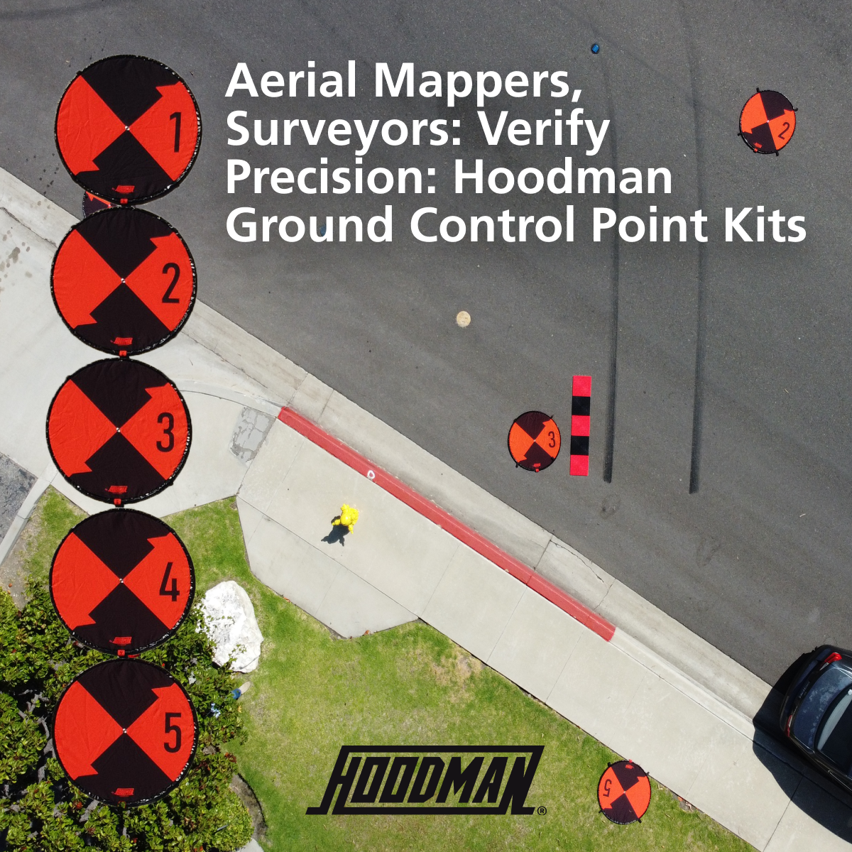
Hoodman makes Highly Visible Ground Control Point (GCP) Kits that come in convenient 5-pad sets, each clearly numbered from 1 to 5. Every pad features a durable center steel grommet with a reinforced plastic backing, allowing you to easily position your RTK staff directly at the center of the pad for precise alignment. Each kit includes a practical carry bag with a shoulder strap, making deployment and storage efficient.
These GCPs are built for durability, like Hoodman’s drone landing pads. Galvanized steel hoops are sewn into the edges of each pad to weigh them down, ensuring they stay in place even in windy conditions. For compact storage, each pad folds down into three circles, neatly fitting into the included bag. For easy identification, numbered tags are sewn along the perimeter, so you can quickly see the pad number without unfolding it.
For added stability, we recommend using the four stake-down loops on each pad when livestock or animals are present, or if the deployment will be overnight. This ensures the pads stay in position, as animals may displace them. If you are working on larger projects, additional kits numbered 6 through 10 are available. Hoodman’s Rugged Reusable Ground Control Point Kits are not only eco-friendly but also a smart investment in the accuracy of your aerial mapping.
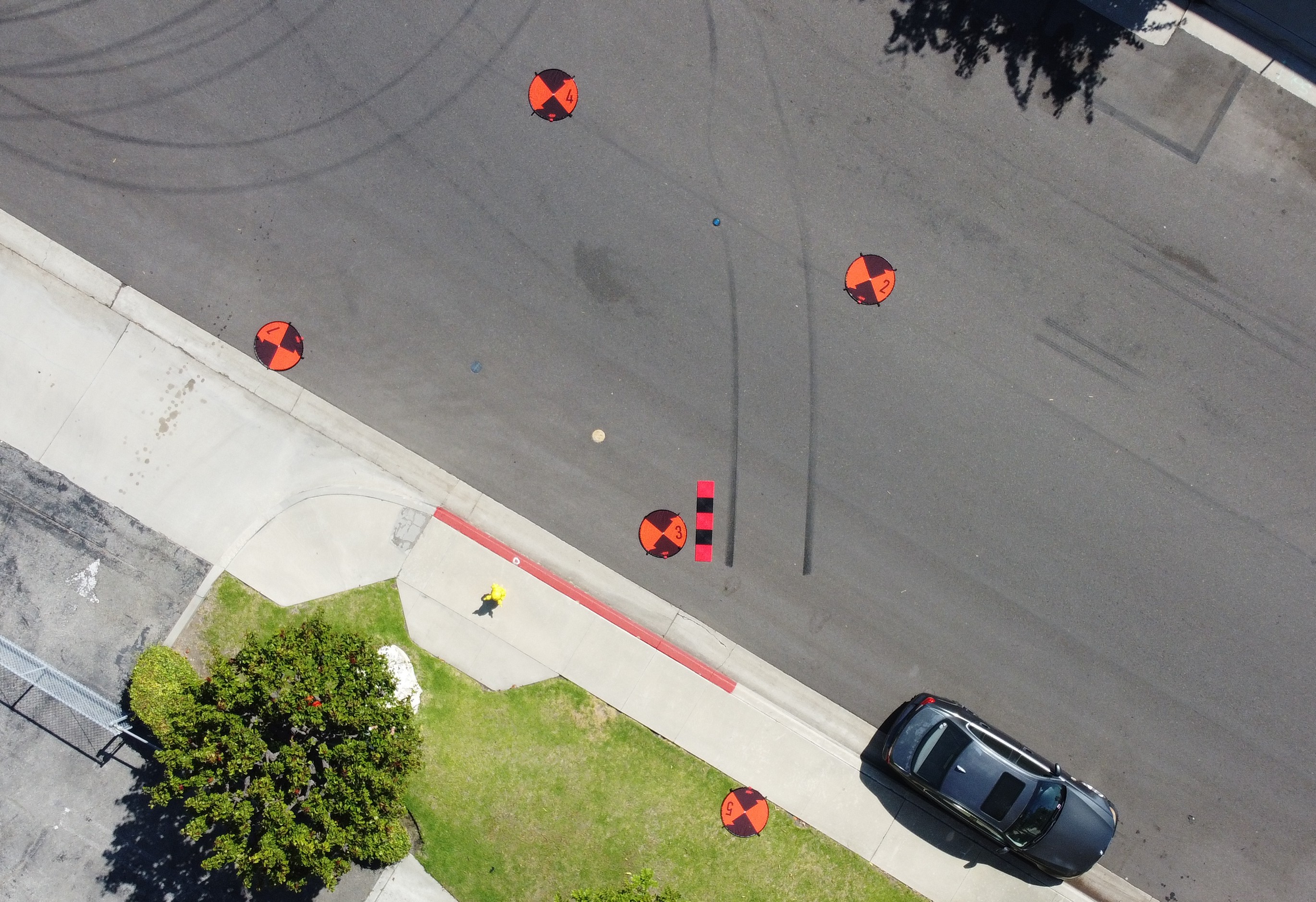
You will also notice the 5-foot red and black line in the image above, which is Hoodman’s SkyRuler. The SkyRuler consists of 5 interlocking 1-foot panels, creating a precise 5-foot measuring scale for your mapping. Law enforcement agencies use SkyRulers to measure the length of skid marks in videos, helping to determine vehicle speed in legal cases. All 5 durable plastic panels of the SkyRuler neatly stack in a shoulder-strap bag for easy transport and storage.
Pricing
- Hoodman Ground Control Point 5-pad Kits: $499.99
- Save $100 when purchasing a 10-pad set.
- SkyRuler: $79.99
Special Holiday Offer!
All Droning Company Pilots save 15% on Hoodman products through Christmas!
Use code: droning101
[Click Here to Shop!]
Watch Hoodman Ground Control Point Kit and SkyRuler in Action
About Hoodman
Founded in 1986, Hoodman Corporation has been at the forefront of creating innovative tools designed to support professional image makers in the field. With a commitment to product development fueled by direct customer engagement at over 14 trade shows annually worldwide for more than 33 years, Hoodman has continually delivered innovative solutions.
Hoodman’s Hood set the industry standard for eliminating glare on broadcast monitors, enhancing visibility in challenging outdoor environments. Recognizing the need for similar solutions for camcorder LCD screens, Hoodman quickly responded. In 1996, the NFL approached Hoodman to create a viewing solution for officials to see instant replays on the field. This collaboration expanded as college football began reviewing calls, and Hoodman once again rose to the challenge, providing updated solutions for the 2021 season.
The digital camera revolution of the early 2000s brought new challenges for photographers, particularly the need to review images in bright outdoor conditions. Hoodman’s patented Hoodloupe was developed to enable glare-free image review on LCD screens. Soon after, the company introduced teardrop-shaped eyecups, helping photographers block out ambient light and maintain a clear view through the camera’s viewfinder.
As digital cameras demanded faster memory cards, Hoodman entered the market in 2006, competing with major brands by producing high-performance, memory cards built with the fastest components available. Hoodman’s commitment to quality and reliability meant higher standards and better performance—because the company believed professional photographers deserve nothing less. Hoodman also pioneered ruggedized metal memory card readers, setting a new standard for durability and reliability.
In 2011, Hoodman introduced its Lens Cleanse kits, providing a green alternative to traditional lens cleaning methods. These convenient, single-use packets—containing a wet and dry towel—eliminated the need for chemical cleaners and leaky bottles, selling over a million units worldwide.
In 2015, Hoodman expanded its product line to support drone pilots, designing the Aviator Hood to eliminate glare from iPads used for drone control. This patented solution included a unique pierceable bottom panel that allowed pilots to access touch screens while protecting against glare. Soon after, Hoodman developed the self-weighted Landing Pad, providing a safe and clean area for drone takeoffs and landings. The bright orange pads became the industry standard, marking the takeoff and landing zones while also alerting nearby manned aircraft of drone activity in the airspace.
By 2017, Hoodman began addressing the needs of aerial drone surveyors, creating Ground Control Point Kits to enhance the accuracy of their mapping and surveying efforts. This development established Hoodman as a leading supplier of tools for aerial mapping.
For over 33 years, Hoodman Corporation has been a pioneer in creating new markets and innovative tools that support professionals in the field. The company’s commitment to sustainability is evident in its green product development, as well as being the first memory card manufacturer to offer a memory card recycling program. Hoodman remains dedicated to making tools that solve real-world problems and improve the lives of its customers, all while supporting environmental responsibility.


