Aaron Reyes

Aaron Reyes
Professional aerial photography in New England
- Drone
- Photography
- Real Estate
- Aerial Inspections
- Mapping
- FAA Part 107 Test Lessons
- Insurance Inspections
- Racing Drones
- Roofing Inspections
- FPV Drones
- Volumetrics
- Modeling
- Drones
- Surveying
- Gps
- Cad Polyline
- Autocad
- Data Management
- Fpv
- Faa Part 107 Compliant Operations
- Airspace Assessment And Authorization (laanc)
- Pre-flight Planning And Risk Assessment
- Site Evaluation And Hazard Identification
- Mechanical Engineering
- Technical Documentation Review
- Specification Interpretation
- Machining Process Development
- Dimensional Analysis
- Tolerance Evaluation
- Tooling Development
- Fixture Design
- Cad
- Additive Manufacturing
- Materials Knowledge
- Technical Research
- Cross-functional Engineering Coordination
- Continuous Improvement
- Professional Photography
- Event Photography
- Off-camera Flash
- Natural Light Shooting
- Composition
- Framing
- Candid Capture
- Real Estate Photography
- Lightroom Workflow
- Drone Videography
- Aerial Video Capture
- Shutter Speed Control
- Faa Part 107 Knowledge
- Drone Operations
- Aerial Photography
- Aerial Videography
- Flight Planning
- Location Assessment
- Mission Preparation
- Safe Flight Practices
- Visual Composition From The Air
- Drone-based Inspection Support
- Client Communication
- Stakeholder Communication
- Small Business Ownership
- Repair A Boat Or Rv
- Build A Computer
- Betaflight
- Fpv Build

About:
I'm a FAA Part 107 certified commercial drone pilot based in the Manchester, New Hampshire area, operating under Aerial Insights LLC. I serve clients across all of New England — New Hampshire, Massachusetts, Connecticut, Rhode Island, Vermont, and Maine.
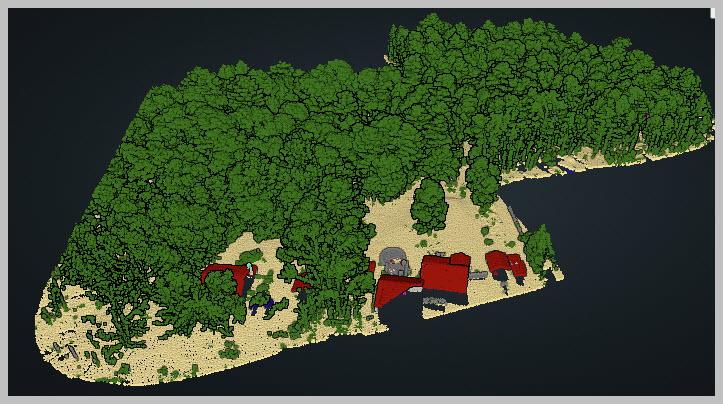
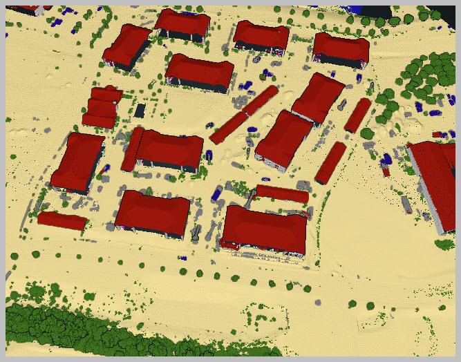
I specialize in survey-grade photogrammetry, facade and structure documentation, and multi-site aerial mapping, using professional-grade equipment to deliver accurate, reliable results for engineering firms, surveyors, contractors, and commercial clients.
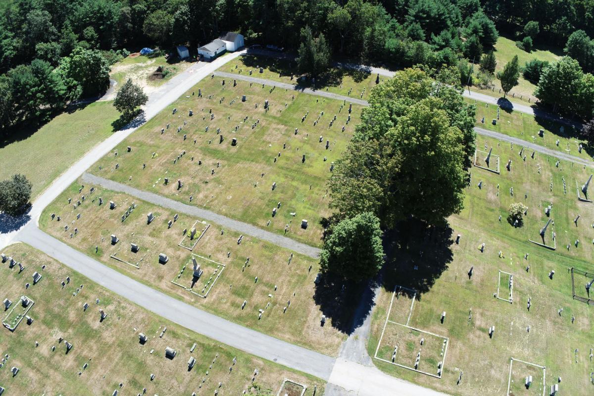
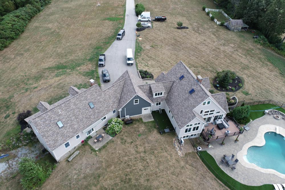
Services include: roof and structure inspections, land surveying support, construction site progress mapping, real estate and property imaging, facade capture, and large-scale orthomosaic mapping.
Safety, data accuracy, and professionalism are at the core of every flight. Contact me to discuss your project and get a quote.
Equipment:
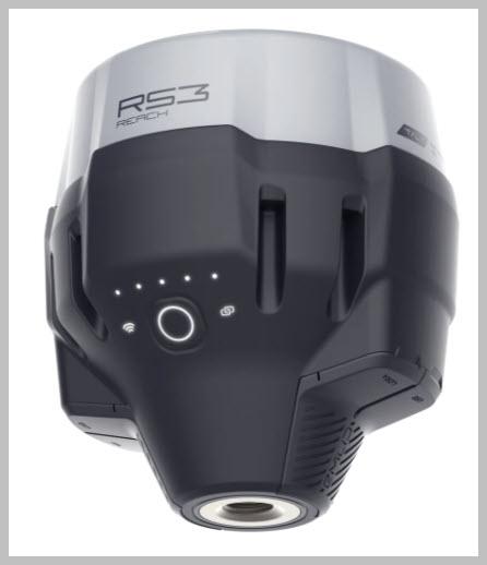
Reach RS3
Manufacturer: Emlid
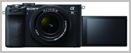
Full frame digital A7CII
Manufacturer: Sony
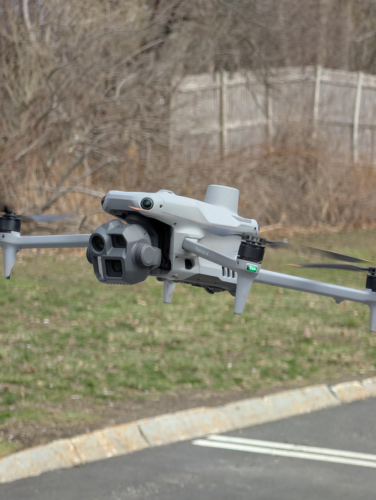
Matrice 4 Enterprise
Manufacturer: DJI
Service Area:
Video Gallery:
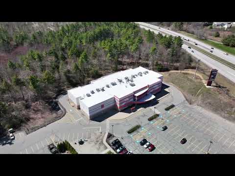
Photo Gallery: