Wardell Willis Willis
Member Since: May 2026
Wardell Willis Willis
Wardell Willis Willis
- Drone
- Photography
- Videography
- Video Editing
- Aerial Inspections
- Mapping
- Cable Inspections
- Cell Tower Inspections
- Commercials
- Construction
- Environmental Monitoring
- Infra-Red Photography
- Power Line Inspections
- Roofing Inspections
- Search & Rescue
- Security
- Wind Turbine Inspections
- Thermography
- Photogrammetry
- Modeling
- Surveying
- Geomatics
- Data Management
- Inspection Experience
- Thermal Inspection Certified
- Faa Part 107 Compliant Operations
- Airspace Assessment And Authorization (laanc)
- Pre-flight Planning And Risk Assessment
- Crew Resource Management (crm) Awareness
- Site Evaluation And Hazard Identification
- Controlled Flight Operations In Commercial Environments
- Structured Capture For Inspection And Documentation Workflows
- Post-flight Data Organization And Delivery
- Drone Tours
- Digital Marketing
- Social Media Marketing
- Root Cause Analysis
- Failure Analysis
- Manufacturing Process Improvement
- Workflow Optimization
- Bottleneck Reduction
- Data Analysis
- Problem Solving
- Systems Thinking
- Continuous Improvement
- Quality-focused Decision Making
- Professional Photography
- Portrait Photography
- Commercial Photography
- Real Estate Photography
- Photoshop Editing
- Real Estate Video
- Drone Videography
- Aerial Video Capture
- Gimbal Operation
- Camera Settings Optimization
- Scene Sequencing
- Post-production Editing
- Footage Organization
- Faa Part 107 Knowledge
- Drone Operations
- Aerial Photography
- Aerial Videography
- Flight Planning
- Location Assessment
- Mission Preparation
- Safe Flight Practices
- Visual Composition From The Air
- Commercial Drone Service Planning
- Drone-based Inspection Support
- Real Estate Aerial Media
- Airspace Consideration
- Risk Assessment
- Project Management
- Process Planning
- Workflow Development
- Schedule Coordination
- Client Communication
- Quote Development
- Timeline Management
- Documentation Control
- Team Coordination
- Stakeholder Communication
- Logistics Management
- Service Development
- Operations Management
- Small Business Ownership
- Customer Service
- Deliverable Management
- Problem Escalation
- Decision Making Under Constraints
- Business Process Improvement
- Instata360 Camera
- Ir Photography Camera
- Rtk Operations
- Orthomosaic Mapping
- Thermal Imaging
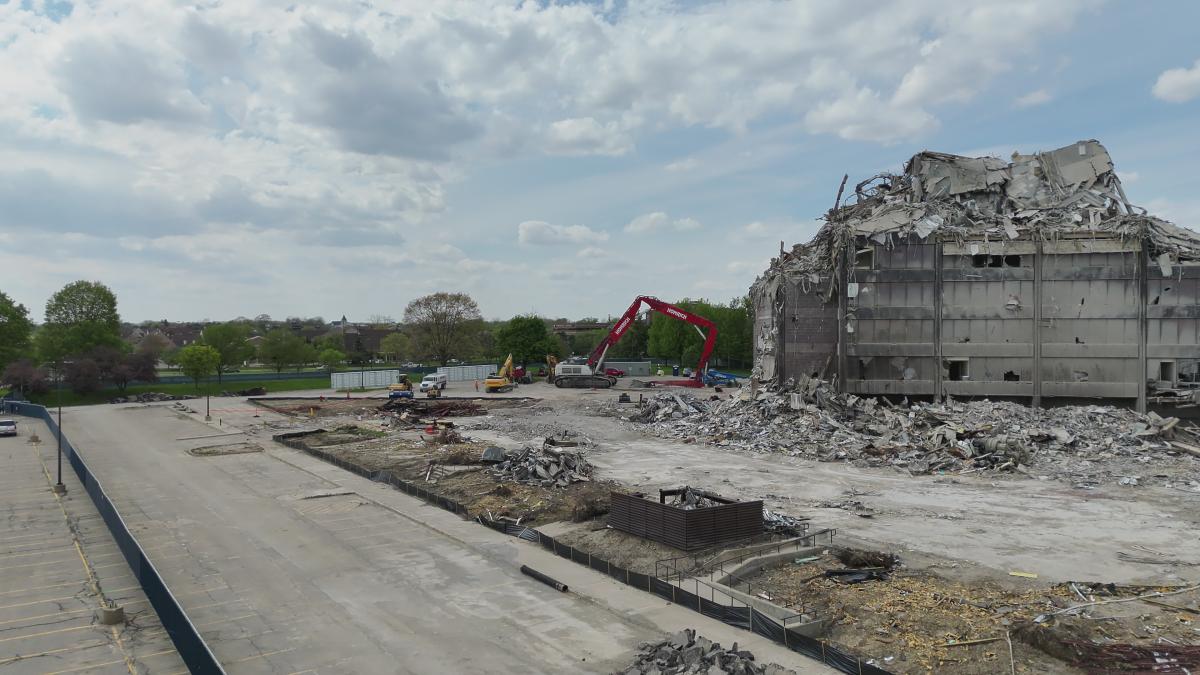
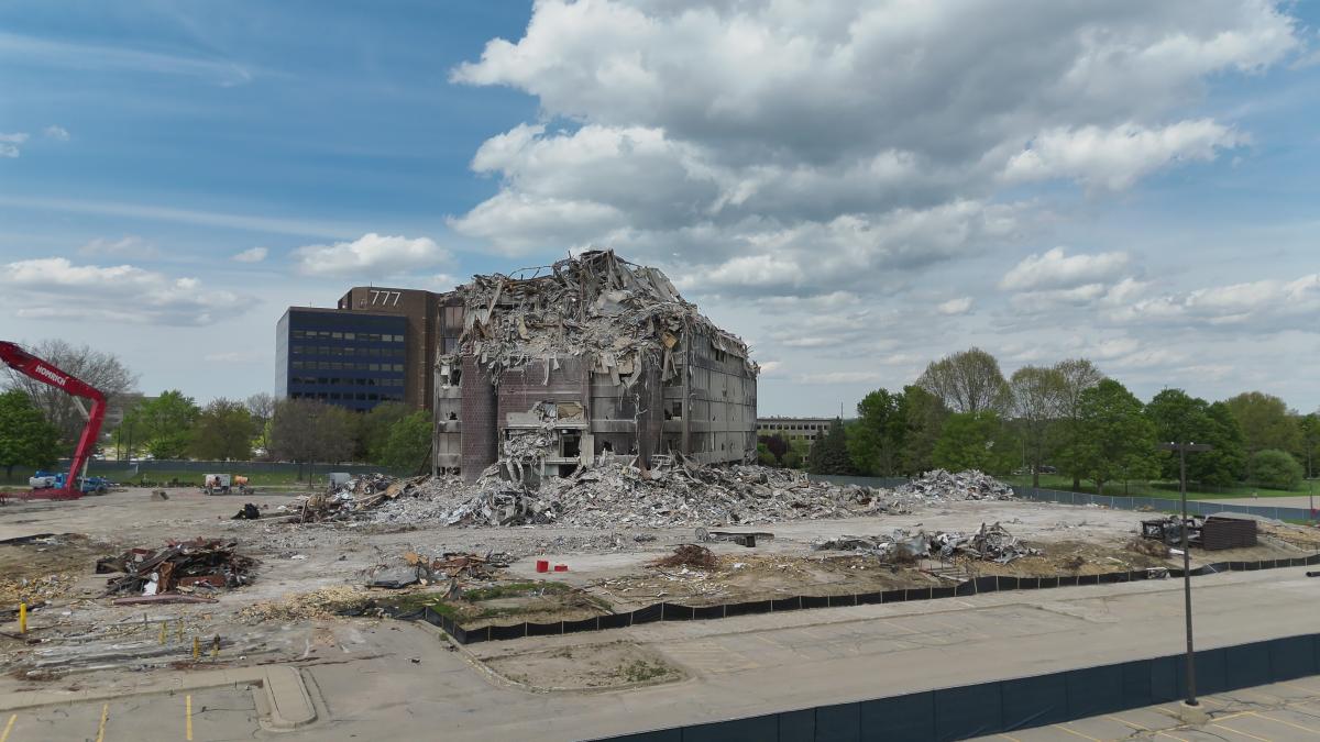
- Construction Progress Monitoring
- Infrastructure Documentation
- Roof Condition Assessment
- Asset Inspection
- Digital Twin Capture
- 360 Virtual Tours
- Dji Pilot 2
- Webodm
- Reality Capture
- Drone Data Processing
- Site Documentation
- Telecom Infrastructure Inspection
- Remote Sensing
- Enterprise Drone Operations
- Mission Planning
- Faa Compliance
- Commercial Uas Operations
FAA Part 107 certified drone operator specializing in aerial inspections, mapping, thermal imaging, construction documentation, and commercial drone operations using enterprise-grade equipment and professional workflows.

About:
I am an FAA Part 107 certified drone operator and owner of True Aerial Precision, focused on delivering professional aerial inspection, mapping, thermal imaging, and visual documentation services. My experience includes construction progress monitoring, infrastructure inspections, orthomosaic mapping, roof assessments, and commercial media capture using advanced drone platforms and 360 imaging technology. I prioritize safe operations, organized deliverables, clear client communication, and efficient workflows to help clients make faster and more informed decisions.
Equipment:
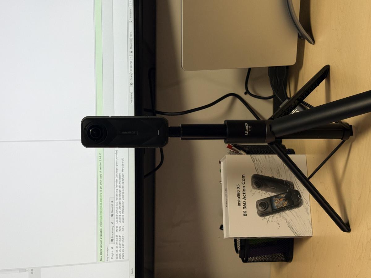
INSTA360 X5
Manufacturer: INSTA360
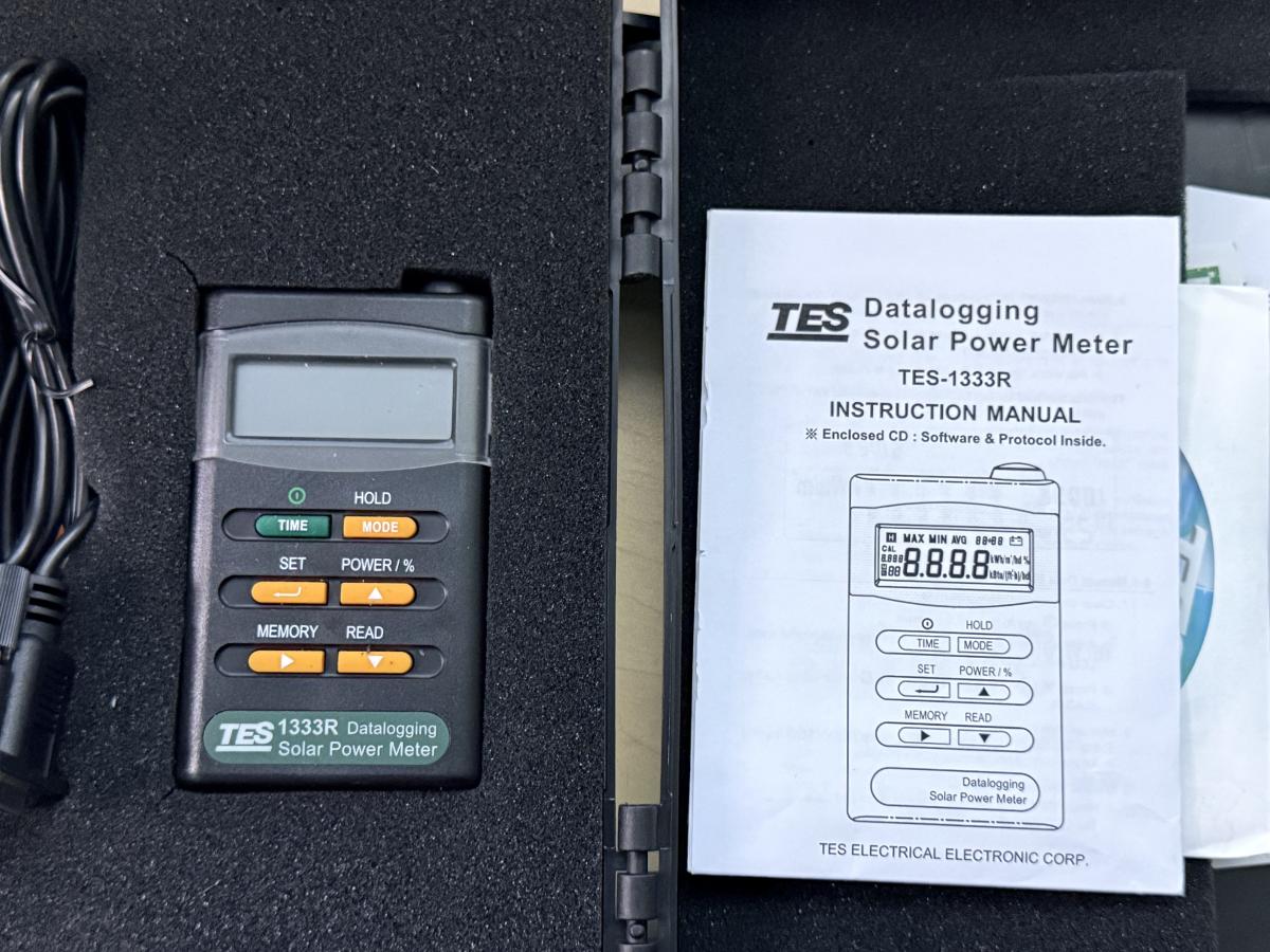
TES-1333R (Solar Power Meter))
Manufacturer: TES ELECTRICAL ELECTRONIC CORP
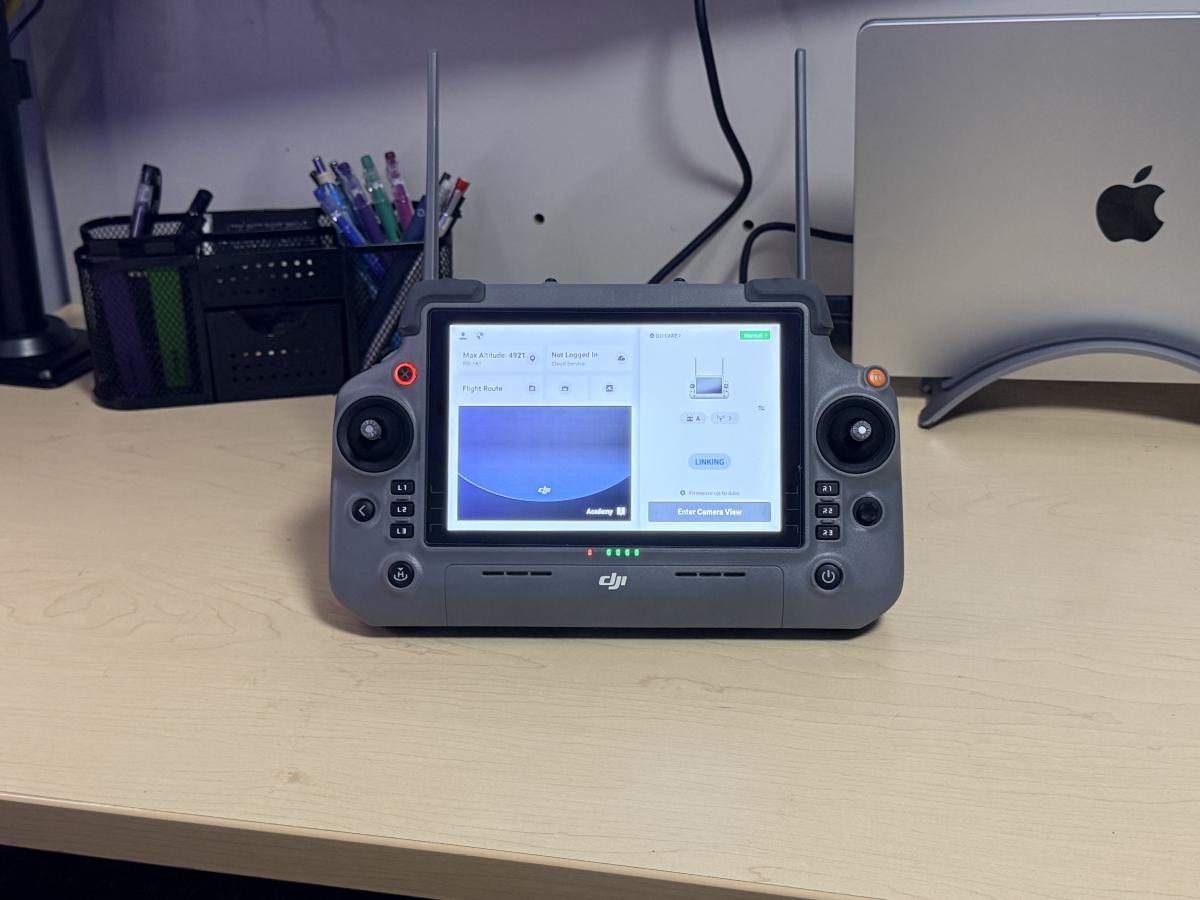
RC Plus 2 (Enterprise Edition))
Manufacturer: DJI
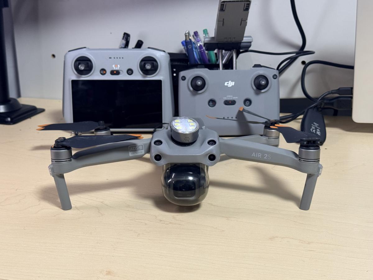
DJI Air 2s
Manufacturer: DJI
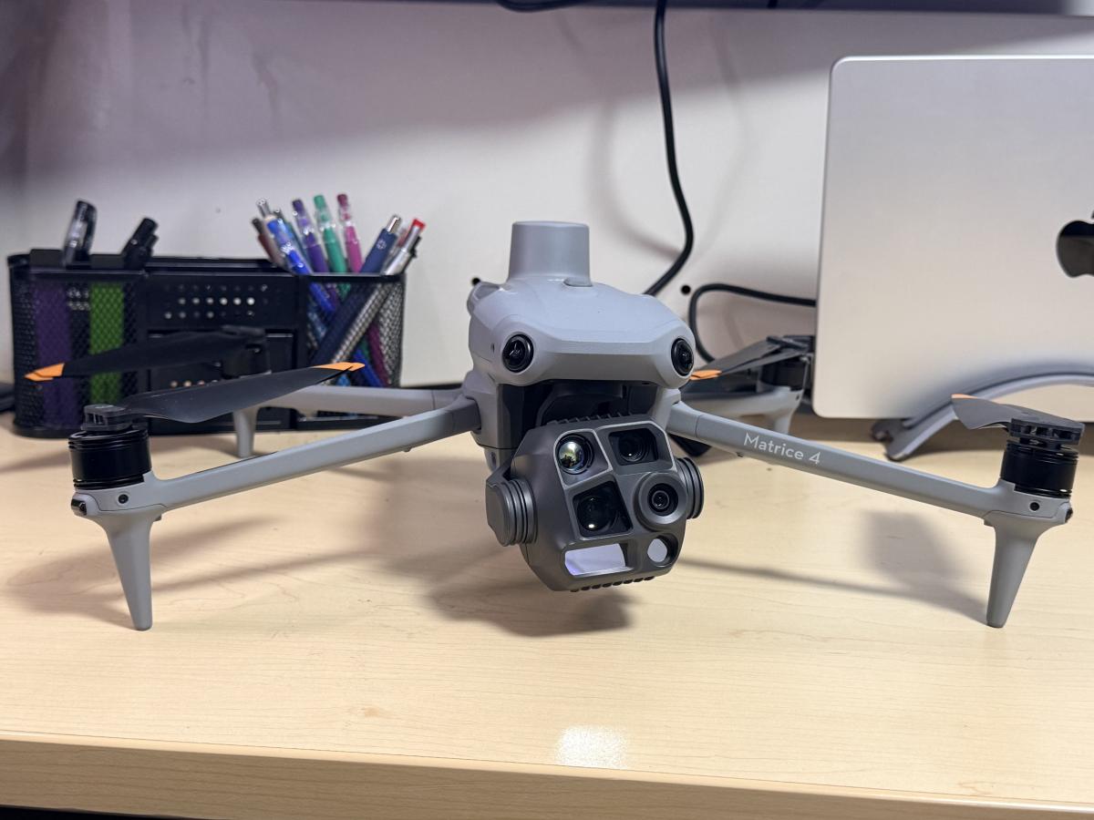
Matrice 4T (Thermal)_
Manufacturer: DJI
Service Area:
Video Gallery:
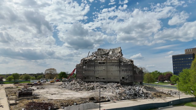
Photo Gallery: