
18 November 2022
By Kelly Brodbeck, product management executive, Teledyne FLIR
As drone technology matures, it must improve and continuously deliver clear value to those investing in it. There is no better example than the combined drone and imaging industry, which is currently experiencing a power curve of growth and innovation. Wide-scale drone adoption for commercial and industrial use cases is increasing as features improve, the imagery becomes more powerful, and software gets more intelligent.
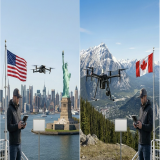
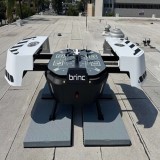
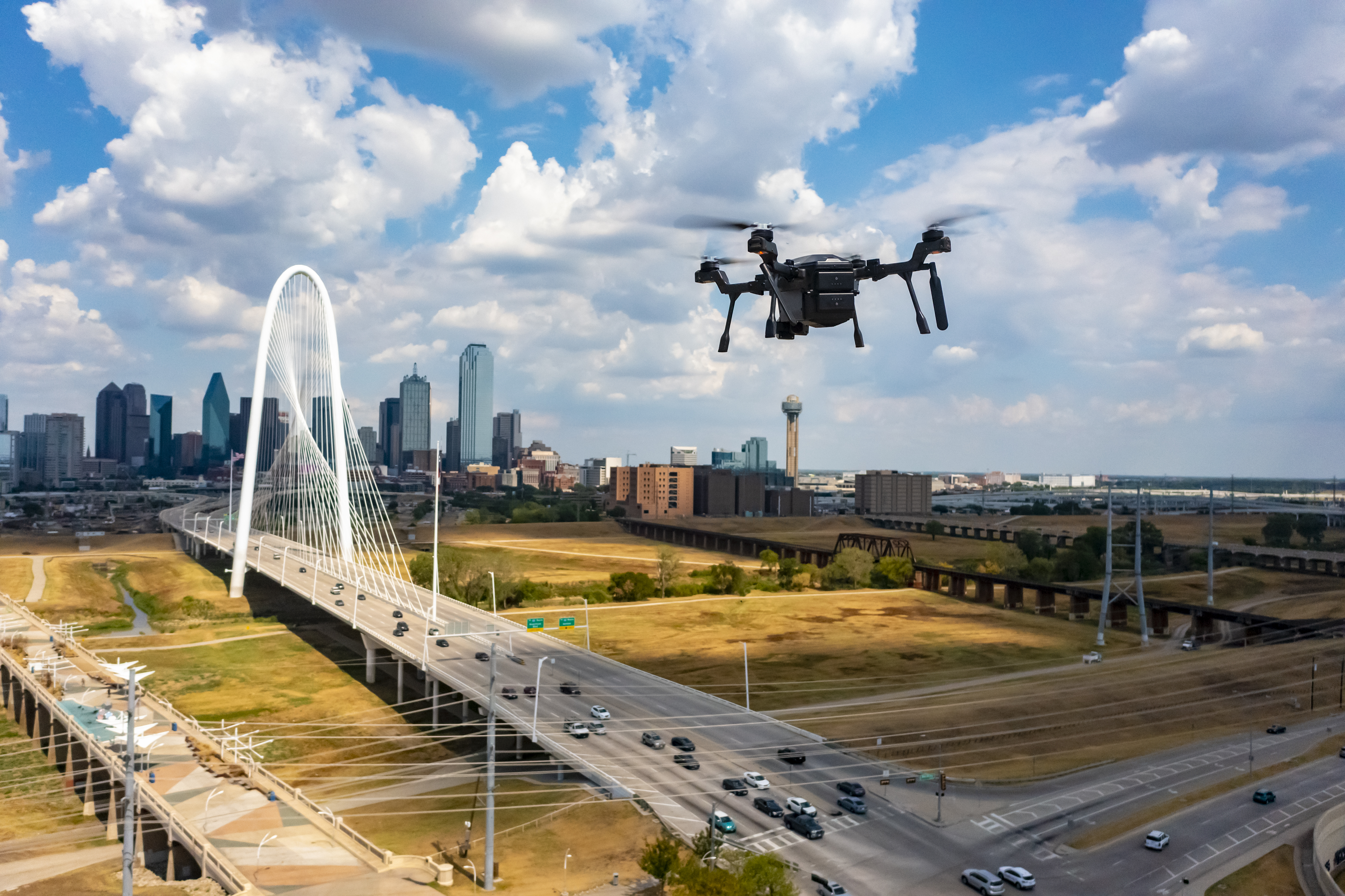
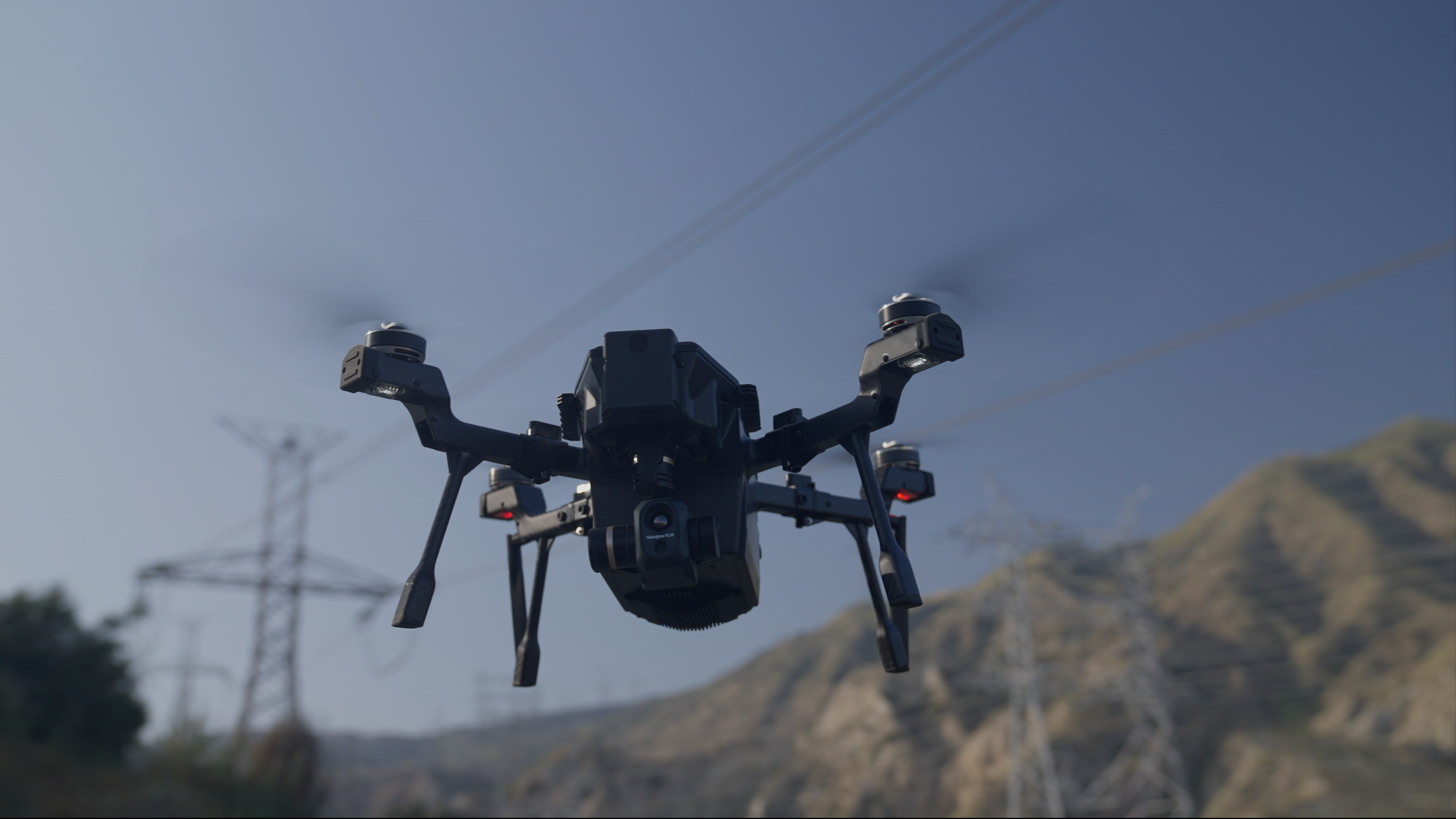
For four decades, Teledyne FLIR has been a market leader in thermal cameras with a wide range of solutions that have expanded to drones, which are also being utilized in an array of settings, from industrial to automotive inspections to prosumer/consumer applications. And recently, the company introduced the SIRAS dual thermal-visible payload drone for commercial and industrial use, priced under $10,000. This new drone allows firefighters, utility workers, and even commercial roofers to inspect quickly and ensure a job is done well.
Teledyne FLIR introduced SIRAS in response to the following three significant trends affecting the public safety and utility markets:
[1] Geofence-Free Flying
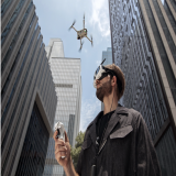
Drone pilots must be able to fly when and where the mission demands, especially public safety and critical infrastructure personnel facing emergencies where time is of the essence. Therefore, pilots need control in their hands to make decisions on where and when they need the drone to fly.
Many drone manufacturers created geo-fencing systems to keep drones from flying in certain places without their approval. Geo-fencing uses the drone’s GPS location to determine whether they’re located within a geo-fenced area and locks the pilot out from flying if the drone is determined to be in the wrong location. While this is often noted as a safety feature, for certain situations, it can prevent pilots from completing the mission and thus creating more safety issues than it solves. Power generation, transmission, and distribution facilities are often considered critical infrastructure and therefore are typically geo-fenced—even for the utility operators who need to inspect these components to keep the power grid functioning.
Recognizing the challenge of making it easier and more viable to inspect utility infrastructure via drone, the SIRAS drone does not use geofencing. This allows FAA Part 107 certificated drone pilots to fly without the added complication of securing approval first via the drone manufacturer, allowing operators to fly when and where the mission demands. It places the responsibility to fly in legal airspace where it belongs – with the pilot.
[2] Cybersecurity
Nation-state bad actors have created a frightening reputation for themselves during the past decade, using cyber exploits and hacks to steal, ransom, sometimes publish, or even destroy highly valuable data from various industrial sources throughout the Western World. Therefore, owning the data captured by the drone and knowing where it goes is pertinent to maintaining effective data security. Removing vulnerabilities, such as requiring cloud storage or creating profiles that increase the threat area, is vital. Also, market demand for drones produced outside China has risen, given concerns about data privacy. That is why SIRAS is engineered for data security by purposely omitting Wi-Fi or cellular capability features and is manufactured and assembled in Taiwan and the USA.
[3] Pixels and Multispectral Imaging
Drone pilots need to see different wavelengths of light, including thermal infrared, especially in public safety and industrial inspection scenarios. The solution is to provide small, lightweight, yet powerful payloads that combine thermal and visible imaging capabilities. In-the-air inspections are more efficient than manual inspections as they can quickly cover a large area. The thermal sensors used on drones can be leveraged for quantitative temperature measurements. But one of the critical factors required to get an accurate qualitative measurement is to have enough pixels on target.
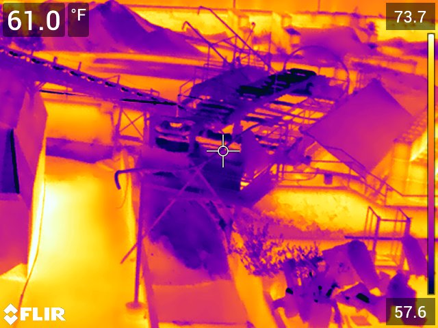
The number of pixels required can vary depending on the thermal camera model, but at minimum, a 2x2 square of pixels is required to provide an accurate temperature reading. Dedicated thermography cameras have a reticle on the screen that shows you when you’ve covered enough pixels to get an accurate measurement of an area.
Previous-generation, drone-based thermal cameras for commercial use don’t often tell the operator when they’re close enough to get an accurate measurement. One or two pixels may be enough to determine that a temperature difference exists qualitatively, but it is not enough to provide an accurate temperature of an area. Therefore, it has been essential for pilots conducting quantitative inspections to get as close as possible to the target for the greatest accuracy. Inspectors have mainly used thermal drones to find qualitative issues, requiring a crew first to verify and then quantify the severity of the problem with other methods. This significantly reduces the overall efficiency of the drone-based inspection process. SIRAS, built with 40 years of thermographic expertise and a reticle representing multiple pixels, removes that uncertainty.
Additionally, the onboard processing capabilities of the SIRAS enable pilots to use the patented MSX® (multispectral dynamic imaging) to get the clarity and context they need to improve decision support. MSX essentially adds visible light details to thermal images in real-time for greater clarity by embedding edge and outline detail from the visible camera onto the thermal image in real-time. Unlike image fusing (merging of visible light and thermal images), MSX does not dilute the thermal image or decrease thermal transparency. Pilots in flight and post-processing review can enjoy greater clarity and context they need to complete the mission effectively.
SIRAS Offers Data-Secure Free Flying with Best-in-Class Thermal Imagery
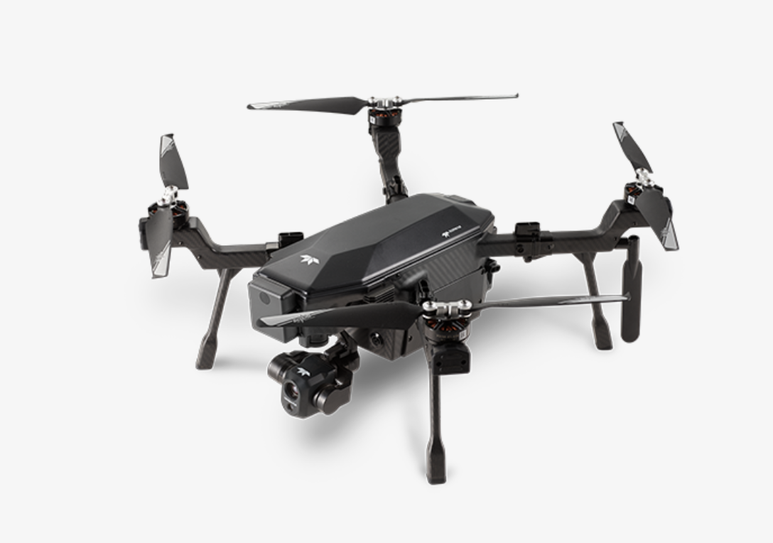
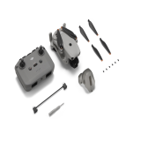
With the Teledyne FLIR SIRAS, operators no longer need to worry about no-fly zones, online data security, or poor-quality images and temperature measurements that need verification and further inspection. The first payload for SIRAS includes dual sensors. A visible camera provides up to 20MP resolution and zoom to 32x to pinpoint details. The companion 640x512 pixel high-resolution FLIR Boson infrared thermal camera provides clear imagery, 5x digital zoom, and temperature-measuring capabilities. These key technology advancements enable SIRAS to save time and money while improving efficiency and safety on the job.
The drone industry has come a long way, and innovation is driving it further. For prospective buyers from a wide range of trades, the numerous benefits of geo-fence-free flying, built-in cybersecurity, and highly accurate temperature measurements make for a complete solution that can be relied upon job after job.
Watch SIRAS