17 March 2026
My name is Geary Miller, and I am an FAA Part 107 certified remote drone pilot based in Tulare, California. I was born in Oakland, California in 1966 and moved to Tulare in 1979, where I attended Tulare Union High School and graduated in 1985.
The Central Valley has been my home for most of my life, and it is the community I proudly serve today through my aerial imaging venture, Miller Aerial Images. My work focuses on providing professional drone services for real estate, agriculture, inspections, construction documentation, and commercial facilities. Every flight I conduct is centered on safety, professionalism, and capturing aerial perspectives that help people better understand and showcase their properties and projects.
My journey into drone aviation began about five years ago while watching a collection of aerial videos on YouTube. What caught my attention was the incredible perspective these small aircraft could provide. From above, the world reveals patterns and beauty that are almost impossible to appreciate from the ground. Farmland becomes a patchwork of geometric shapes, rivers carve elegant paths through landscapes, and cities reveal the organized complexity of their streets and neighborhoods. Watching those videos sparked something in me. I realized that drones offered a completely new way to experience the world, and I wanted to learn how to capture those perspectives myself.
Like many people entering the drone world, my first step into flying began with a very inexpensive drone. I found one for about fifty dollars and figured it would be the perfect training tool. It seemed like a low-risk way to learn the basics of flight control before investing in more advanced equipment. In theory, it was a good plan. In reality, however, the drone had other ideas about its future.
During one of its early flights, the drone decided it didn’t want to follow my instructions anymore and began drifting toward a nearby street. Before I had much time to react, it encountered a passing car that had absolutely no interest in participating in a drone pilot’s training exercise. The car continued on its way without even slowing down, but my drone’s aviation career ended right there on the pavement. The aircraft was completely destroyed in the encounter, leaving me standing there realizing two things at once: first, that drones and moving vehicles don’t mix very well, and second, that quality equipment matters. Looking back, it was a frustrating moment at the time, but it’s one I can laugh about now. That short-lived fifty-dollar drone taught me an unforgettable lesson about reliability and control, and it ultimately pushed me to take drone aviation more seriously.
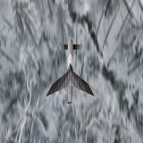
About a week later I upgraded my equipment and purchased a DJI Air 2S, and the difference between the two aircraft was incredible. The Air 2S offered stability, precision controls, and a professional-grade camera system that made flying feel completely different. For the first time, I was able to experience what drone aviation was really supposed to feel like. The aircraft responded smoothly, held its position steadily in the air, and captured stunning images from above. That upgrade changed everything for me. What started as a casual interest quickly turned into a genuine passion for aerial photography and drone flight.
Over the next four years I spent countless hours practicing and refining my skills. I flew regularly, studied drone operations, and learned how to safely operate aircraft in a variety of environments. Every flight helped me better understand flight control, aerial composition, and camera positioning. I also began experimenting with different types of drone shots—wide landscape views, slow cinematic passes, overhead perspectives, and structural angles that highlight the shape and layout of properties. With each flight I became more comfortable in the air and more confident in my ability to operate drones safely and effectively.
As my experience grew, so did my interest in using drone technology for practical applications. I began to see how valuable aerial imagery could be for industries such as real estate, agriculture, and construction. Aerial views allow people to see the full layout of a property, the condition of a roof, the progress of a construction project, or the patterns of farmland and irrigation systems. In many cases, drones provide information that simply cannot be captured from ground level.
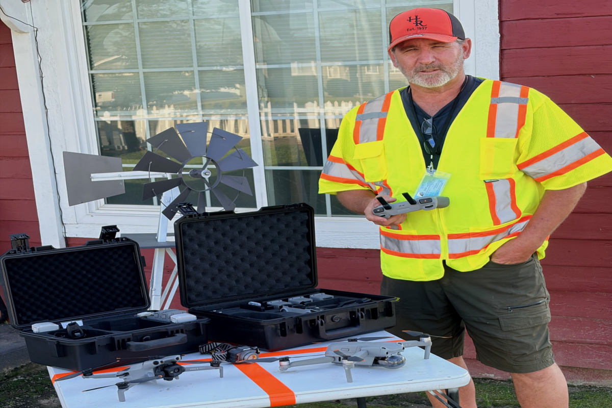
After several years of building experience, I decided it was time to pursue my FAA Part 107 certification so that I could operate drones commercially. In preparation for the exam, I connected with a mentor named Gary McPherson from New York who helped guide me through the certification process. Over the course of two weeks we worked through focused training sessions via video chat, reviewing airspace classifications, aviation safety procedures, weather patterns, and the regulatory knowledge required to operate drones professionally. After completing the training, I scheduled my exam and successfully earned my FAA Part 107 Remote Pilot Certificate, officially becoming licensed to conduct commercial drone operations.
Receiving my certification was a major milestone. Not long afterward, I completed my first commercial drone job for a real estate firm. The project involved capturing aerial imagery that highlighted the property layout and surrounding landscape in a way that traditional photography simply could not. Seeing how much aerial imagery enhanced the presentation of the property reinforced the value that drone technology can provide to clients. That first project marked the beginning of my professional work in aerial imaging.
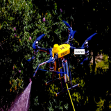
Today, through Miller Aerial Images, I provide aerial photography and inspection services for a wide range of applications. Real estate marketing remains one of the most powerful uses for drone imagery, as aerial photos and video allow potential buyers to see an entire property and its surroundings at a glance. I also work with agricultural properties where aerial imagery can reveal crop patterns, irrigation layouts, and land features that are difficult to evaluate from the ground.
In addition, I provide roof inspections and structural imaging that allow property owners to examine buildings safely without climbing ladders or scaffolding. Drone inspections can quickly reveal damage, wear, or structural concerns while keeping workers safely on the ground. Construction companies can also benefit from aerial documentation that tracks the progress of projects over time, providing clear visual records from start to finish.
Another capability I offer is indoor drone flight for large buildings and warehouses. Using smaller drones designed for confined spaces, I can capture images and video inside structures that would otherwise be difficult to inspect. Indoor drone flights can document ceilings, beams, lighting systems, and storage areas with remarkable efficiency. This type of work highlights just how versatile drone technology has become when used correctly.
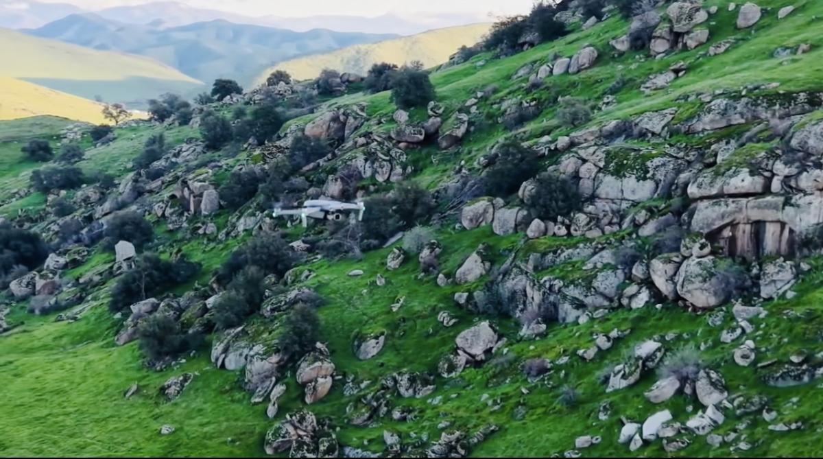
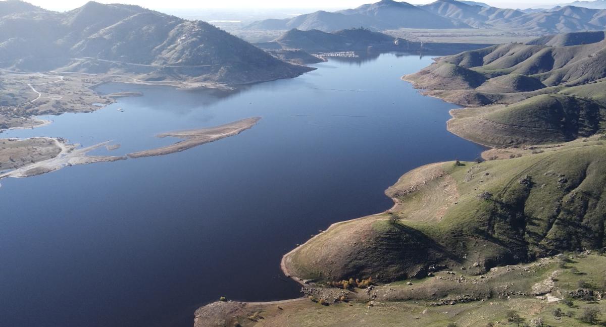
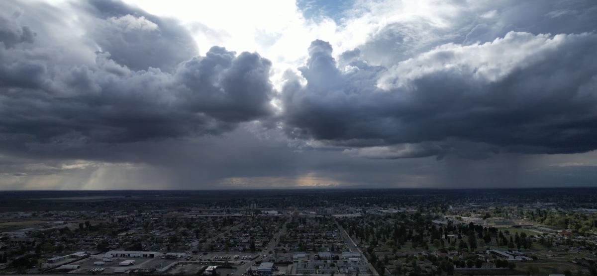
Beyond my professional work, I’ve always enjoyed exploring the natural beauty of landscapes through aerial photography. Flying drones allows me to capture scenic locations such as mountains, lakes, farmland, and cities from angles that most people never see. Even familiar places can look completely different when viewed from the sky. That sense of discovery continues to inspire me every time I launch a drone.
Outside of aviation, I also compete in horseshoe pitching, a hobby that requires patience, precision, and consistent technique. Interestingly, many of the same qualities that help in competitive horseshoe pitching apply to drone piloting as well. Both activities require focus, steady control, and the ability to make small adjustments to achieve the desired result. Over time I’ve found that the discipline and patience developed through competition translate well into the careful operation required in drone flight.
As drone technology continues to evolve, I remain committed to growing my skills and expanding the services I provide through Miller Aerial Images. The drone industry is advancing rapidly, offering new opportunities for aerial imaging, inspections, mapping, and creative photography. Being part of that innovation is something I truly enjoy.
At the end of the day, my goal is simple: help people see the bigger picture. Whether I’m capturing aerial imagery for a real estate listing, documenting farmland, inspecting a structure, or filming scenic landscapes, I strive to deliver professional results that showcase the full potential of aerial perspective.
Drone aviation has given me the opportunity to combine technology, photography, and exploration into meaningful work. I look forward to continuing to serve clients throughout the Central Valley and beyond, helping them experience their properties and projects from a viewpoint that only aerial imaging can provide.
Check Out My Work!