15 May 2026
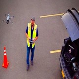
My name is Dan Gierke, and I’m an FAA Part 107 certified drone pilot based in the Chicago area and the founder of Chicago Drone Service. What started as a fascination with technology and aerial imagery eventually evolved into a passion for using drones as powerful business tools for inspections, mapping, preservation, and visual storytelling.
Like many pilots, I was initially drawn to drones because of the unique perspective they provide. Seeing familiar places from above completely changes how you experience the world. But very early on, I realized drones were capable of much more than simply capturing cinematic footage or beautiful photographs. They were becoming tools that could help businesses collect data faster, inspect difficult-to-access structures safely, document projects more efficiently, and create entirely new workflows that simply weren’t possible before.
That realization completely changed my direction.
As I continued learning and improving my flying skills, I pursued my FAA Part 107 certification and started focusing more heavily on commercial drone operations. I became increasingly interested in how drones could solve real business problems. Instead of viewing drones solely as flying cameras, I started viewing them as advanced aerial data collection platforms.
That mindset eventually led to the creation of Chicago Drone Service.
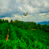
From the beginning, I wanted the company to focus on professionalism, reliability, safety, and high-quality deliverables. Chicago is an incredible environment for drone work because the city offers such a unique combination of architecture, infrastructure, construction, real estate, industrial properties, and historic buildings. Every project presents different challenges and opportunities.
Today, my work spans multiple industries and service types, including aerial photography, videography, commercial roof inspections, construction progress tracking, orthomosaic mapping, photogrammetry, and 3D modeling.
In addition to Chicago Drone Service, I also own a rapid prototyping and technology development company called Next Level Solutions. Through that company, I’ve been able to combine my passion for drones, software, workflow optimization, and emerging technology to create solutions designedspecifically for real-world operational challenges faced by pilots and businesses.
One of the projects I’m most excited about is the recent launch of our mobile application, Mission Planner for DJI Drones, now available on the Apple App Store. The app was designed to solve a major frustration many drone pilots experience in the field.
Traditionally, creating automated enterprise-style waypoint missions often required pilots to plan at home on a PC or carry laptops into the field. I wanted to simplify that entire workflow and make mission planning dramatically faster and more accessible.
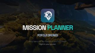
Mission Planner for DJI Drones allows pilots to create automated missions directly from their iPhone or iPad while standing on-site, often in under 10 seconds. Pilots can quickly generate missions without needing expensive enterprise software platforms, complex workflows, or desktop-based planning tools. The goal was to create a streamlined, affordable solution that gives more pilots access to advanced automated flight planning capabilities directly from mobile devices.
Building the app also gave me a deeper appreciation for how quickly drone technology and software ecosystems are evolving together. Drones are no longer just hardware platforms. They’re becoming integrated technology ecosystems where software, automation, aerial data, and workflow efficiency all play critical roles.
One of the areas I became especially passionate about was commercial inspections and mapping. Drones have completely transformed how inspections can be performed. Instead of relying solely on ladders, lifts, or manual observation, drones allow us to safely capture high-resolution imagery and detailed visual data from perspectives that would otherwise be difficult, expensive, or dangerous to
access.
Commercial roofing inspections became a major focus for me because they combine technical precision with real-world value. Property owners, contractors, and facility managers can benefit tremendously from accurate aerial imagery and detailed documentation. Drones can help identify visible damage, drainage issues, membrane conditions, facade concerns, and other problem areas while reducing risk and improving efficiency.
As my experience grew, I also became deeply interested in photogrammetry and 3D modeling. The ability to transform hundreds or even thousands of aerial images into detailed digital models is something I still find fascinating today. Using advanced workflows and drone platforms, I’m able to create orthomosaic maps, textured 3D models, and detailed digital representations of structures and properties.
This side of the industry opened my eyes to how important drones will become in the future of digital infrastructure, inspections, preservation, and construction workflows. We’re rapidly moving toward a world where digital twins and aerial data will become standard tools across countless industries.
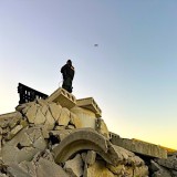
One of the most meaningful projects I’ve been working on involves documenting and digitally preserving historic churches throughout Chicago. Chicago has some of the most beautiful and architecturally significant churches in the country, and many people never truly appreciate the scale and craftsmanship of these structures from the ground.
Using drones, I’m able to capture these buildings from perspectives rarely seen before while also creating detailed visual records that may help preserve their history digitally for future generations. This work combines several of my passions together: aviation, technology, architecture, history, and storytelling.
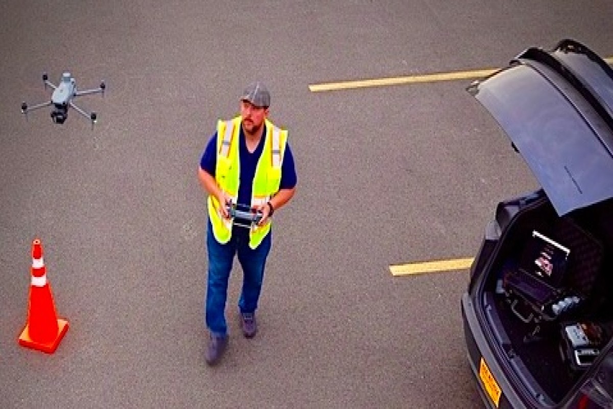
Flying in a dense urban environment like Chicago also requires a high level of planning and professionalism. Every mission involves careful consideration of airspace, safety, weather conditions, obstacles, and operational risks. I take those responsibilities seriously because professional drone operations are about far more than simply launching a drone into the air. Communication, preparation, safety, and delivering a polished final product are equally important.
Over time, I’ve built a drone fleet designed to handle different types of commercial work. Different missions require different tools, and having access to multiple aircraft allows me to choose the best platform for each specific project.
Some of the primary drones I currently operate include the DJI Matrice 4E, DJI Mavic 3 Pro, DJI Air 2S, and several compact drone platforms used for agile aerial capture and inspections. Each aircraft serves a different purpose depending on the environment, client needs, and deliverables required.
The DJI Matrice 4E has become especially valuable for enterprise-style mapping and inspection workflows because of its advanced imaging capabilities and efficiency on larger projects. For cinematic content and real estate media, the Mavic 3 Pro provides incredible image quality and flexibility.
Beyond the flying itself, I’ve also become heavily involved in the software and technology side of the drone industry. I enjoy exploring ways to improve workflows, simplify mission planning, and makedrone operations more efficient for pilots and businesses alike. The drone industry is evolving incredibly fast, and one of the most exciting parts of being involved in this field is seeing how quickly new technologies are changing what’s possible.
I truly believe drones are still in the early stages of their long-term impact across industries. We’re already seeing major adoption in construction, inspections, roofing, mapping, agriculture, public safety, infrastructure management, and real estate. In the future, I think drones and aerial data collection will become integrated into everyday business operations in ways most people still don’t fully realize.
For anyone looking to become a professional drone pilot, my biggest advice is to focus on professionalism and value creation. Flying is important, but understanding how to solve client problems is what ultimately builds a successful business. Learn how industries operate. Understand client pain points. Become reliable. Communicate well. Deliver consistently high-quality work.
I also strongly encourage new pilots to continue learning beyond basic photography and videography. Mapping, photogrammetry, inspections, and data collection are creating enormous opportunities within the commercial drone industry. The pilots who learn how to combine technical skills with business understanding will be the ones who stand out long term.
At the end of the day, what I enjoy most about this industry is that every project is different.
One day I might be capturing aerial media for a commercial property, the next I could be documenting a historic church, inspecting a roof, building a 3D model, or creating mapping data for a client. The variety keeps the work exciting and constantly pushes me to keep improving.
The drone industry continues to evolve rapidly, and I’m excited to continue growing alongside it while helping clients leverage aerial technology in practical, innovative, and meaningful ways.
You can learn more about my work at https://chicagodroneservice.com and explore Mission Planner for DJI Drones on the Apple App Store.
Watch!