
30 April 2025
SPH Engineering releases a new version of UgCS software that improves elevation data accuracy, makes mission planning easier, and introduces several enhancements to improve user experience. The new features include the ability to explicitly set flight altitude in photogrammetry and corridor missions, support for DJI M3D and M3TD drones, and access to USGS 1/3 Arc Second elevation data for users in the United States. These updates simplify mission planning and precision, improving drone operators' safety and efficiency.
Practical Enhancements for Professional Users
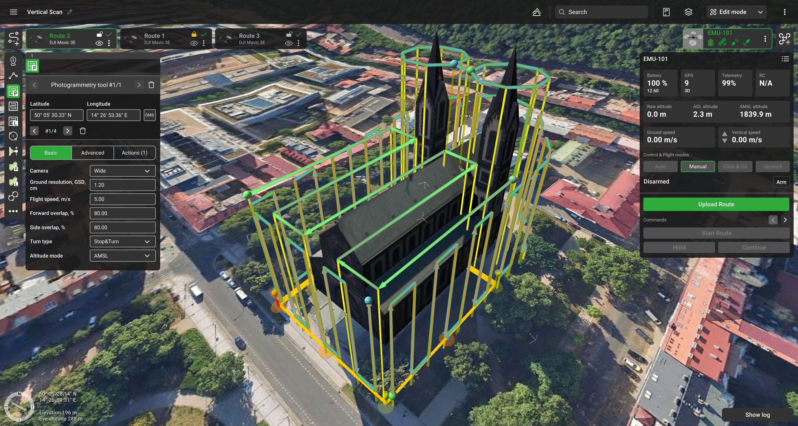
Responding to long-standing feedback from users, UgCS now allows drone pilots to define the exact flight height when planning photogrammetry and corridor mapping missions—no longer requiring Ground Sample Distance (GSD) as the only input. This long-requested feature brings clarity and control to mission planning, especially for users who need to fly at specific altitudes and understand their expected image resolution.
"Our users have asked for more flexibility and clarity in setting flight height in photogrammetry missions. With this update, we've not only delivered that but also aligned UgCS with the standards professional pilots expect from leading flight planning tools," says Kristaps Brass, UgCS Product Owner.
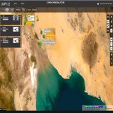
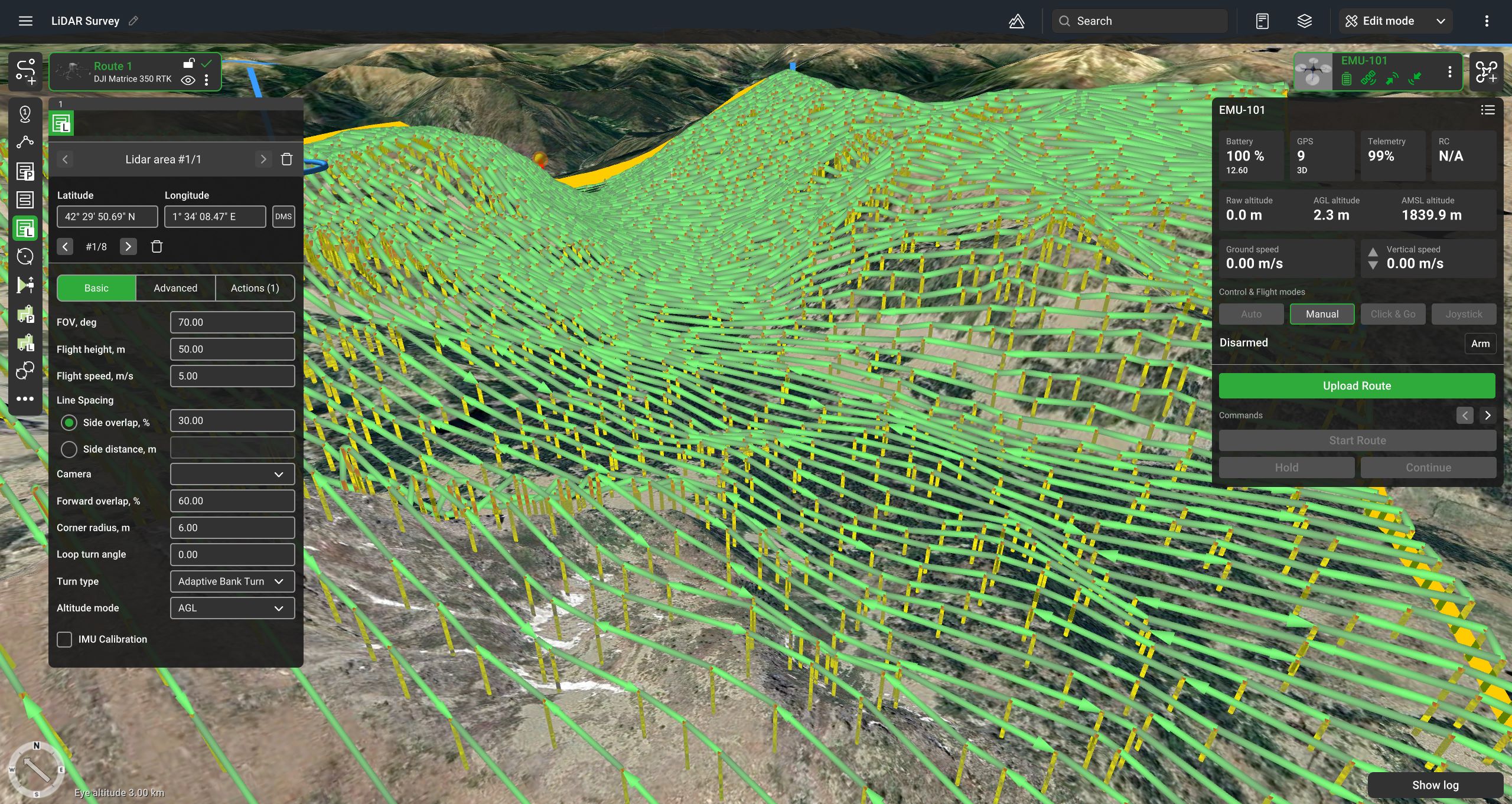
Another significant improvement is the integration of USGS 1/3 Arc Second elevation data for all UgCS users flying within the United States. This increases the default elevation data resolution threefold—from one data point every 30 meters to one every 10 meters—greatly enhancing the accuracy of terrain-following missions. This means safer, more efficient operations in complex or mountainous terrain.
More Visibility, Smarter Defaults
To enhance the overall user experience, the new UgCS version also includes several interface enhancements:
- The "Export Route" button is now more prominent and easily accessible, mainly benefiting users of the UgCS Open version.
- The five most popular drone models are displayed first when creating a new route, speeding up the planning process.
- Drones with built-in multi-lens cameras will now automatically default to the wide camera when planning photogrammetry routes, reducing manual adjustments.
- The Visual Inspection route category has been expanded with a Circle tool, making it easier to plan circular orbits around points of interest.
- For new installations, No-Fly Zones (NFZs) are now disabled by default, allowing faster setup and quicker mission planning out of the box.
Additionally, support has been added for two new DJI drones, DJI M3D, and M3TD, further expanding the range of hardware compatible with UgCS.
The new version of UgCS is available globally, with USGS elevation data automatically applied when planning missions within U.S. territory.
The latest 5.9 version is available here.
Further information:
Piotr Domanski
E: pdomanski@ugcs.com
***
About SPH Engineering
SPH Engineering is a leader in drone technology development, providing UAV software solutions, integration services, and custom development to advance drone applications for surveying, data collection and processing, and entertainment. Founded in 2013 in Latvia (EU), SPH Engineering has a global customer and partner network in over 150 countries. Core technologies developed by SPH Engineering:
- UgCS: Flight Planning & Control– One of the world's leading flight-planning software solutions for complex drone surveys.
- Integrated Systems– The core technology SkyHub enables the advanced integration of drones, diverse sensors, and UgCS software, expanding capabilities in geophysical, hydrographic, industrial, archaeological surveying, and environmental monitoring.
- Data Processing & Custom Development– Solutions for image, point cloud, and geophysical data processing to facilitate drone-based businesses.
- Drone Show Technologies– All-in-one solution to manage drone light shows for entertainment and advertising.